The Sprints
The Ozark Run Scenic Byway is a long route, covering 78 miles across 2 counties in Missouri. It is most efficient to describe it in two segments, which we call “Sprints”.
The color-coded map to the right shows the sprints, and how they connect to each other.
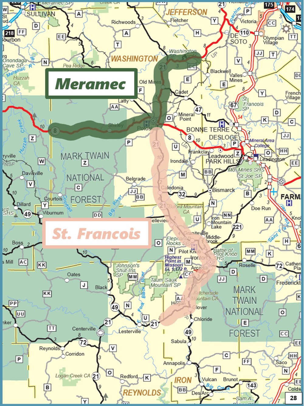
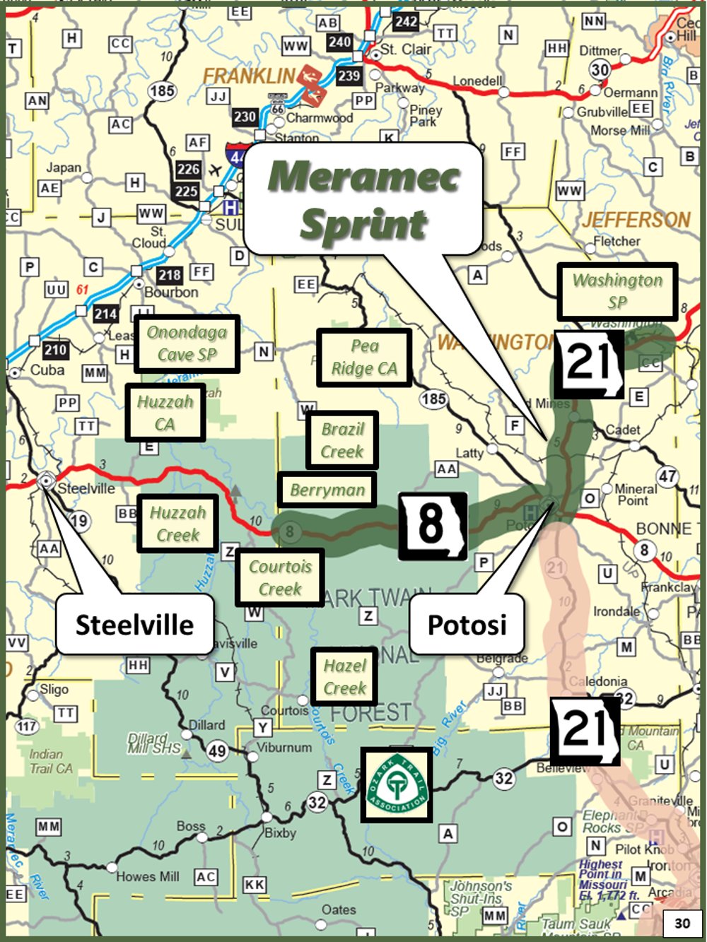
Meramec Sprint
Road: Route 21, Route 8
Begin: Washington State Park
End: Berryman MO
Length: 35 miles
The Meramec Sprint stretches between the Big River and Courtois Creek, two major tributaries of the Meramec River. The sprint starts in Washington State Park, where Route 21 crosses the Big River into Washington County, then proceeds south through the historic village of Old Mines to Potosi.
West of Potosi, the road gently meanders through wooded hills, quiet valleys, and fertile farms. This sprint crosses through Mark Twain National Forest, which contains creeks, campgrounds, fishing lakes, and the northern reaches of the Ozark Trail. The byway officially terminates at Berryman, but just a few miles further along Route 8 are three of the most popular Ozark floating streams: the Courtois, the Huzzah, and the Meramec. This area has several public river access points, canoe and kayak outfitters, and outdoor resorts.
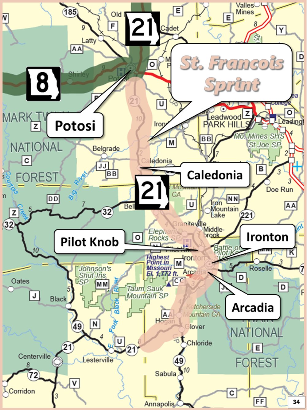
St. Francois Sprint
Road: Route 21
Begin: Potosi
End: Iron/Reynolds County line
Length: 43 miles
The St. Francois Sprint starts in Potosi, and passes through the historic town of Caledonia on its way to the scenic Arcadia Valley. The towns of Pilot Knob, Ironton, and Arcadia are nestled together among the ancient St. Francois Mountains, and is a popular destination for outdoor enthusiasts. South of Arcadia, the road passes through Royal Gorge. The St. Francois sprint ends at the Iron County line.
This area is home to dozens of parks, conservation areas, campgrounds, wilderness areas, and hiking trails, including three popular Missouri state parks – Elephant Rocks, Taum Sauk Mountain, and Johnson’s Shut-Ins. Two divisions of the Mark Twain National Forest are also in the neighborhood. Just minutes beyond the byway, the three forks of the Black River join near Lesterville, a popular stop for camping and floating.